Varanasi Smart City project status and visitor navigation
Varanasi is trying to solve a difficult urban equation: how to move a large daily visitor population through a historic core whose streets, ghats, and temple approaches were not designed for modern traffic volumes.
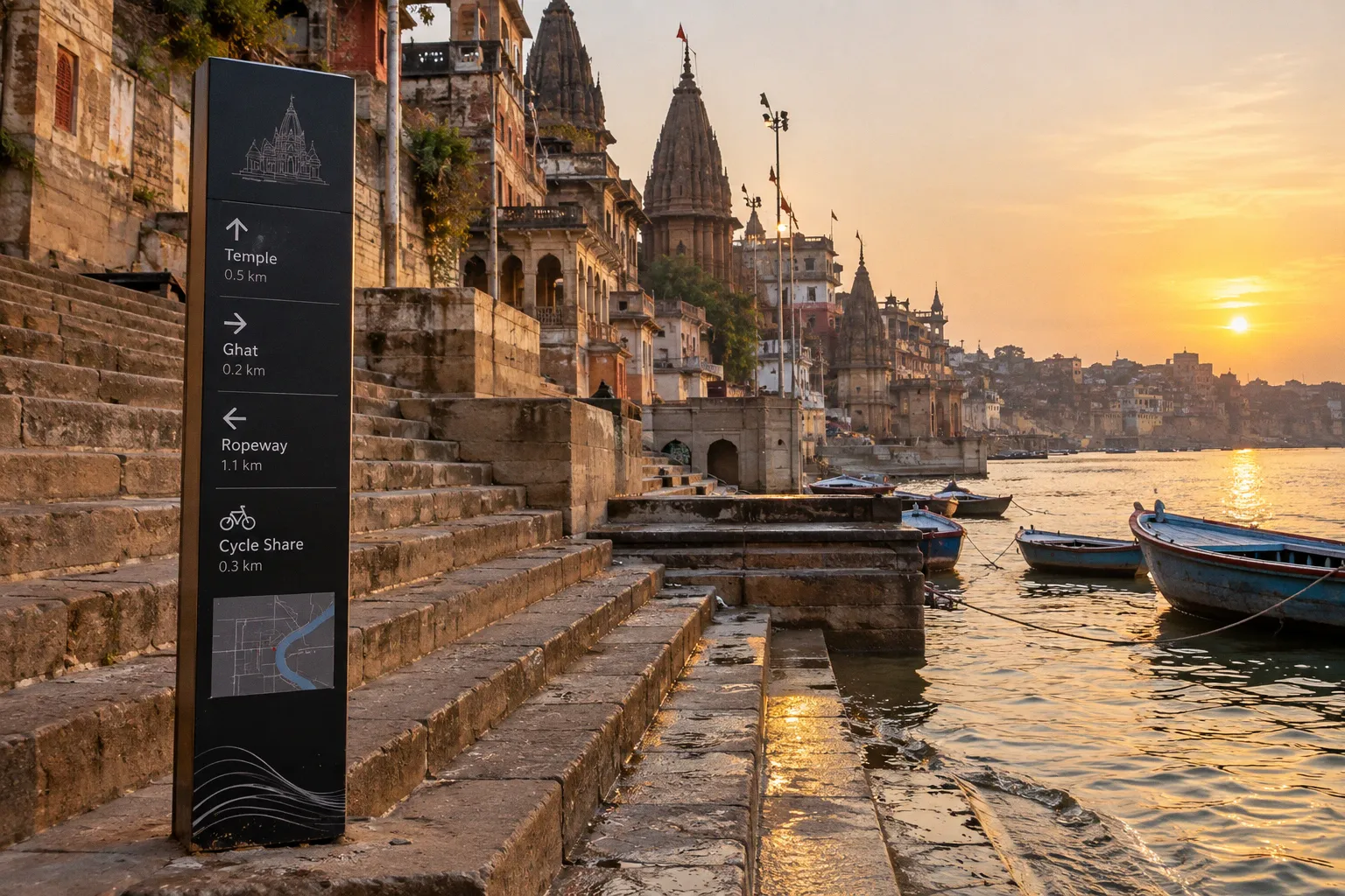
Varanasi Smart City Project Status for Tourists: Updated Transit and Navigation Routes
On peak days, the city is commonly described as handling between 500,000 and 600,000 non-resident arrivals, alongside a permanent residential population estimated at approximately 2.2 to 2.5 million.
That pressure explains the shape of the current smart-city programme. The major projects are not limited to a single app or a new transport line. They combine an aerial transit corridor, proposed AI mobility tools, digital visitor services, QR signage along the ghats, and a public bike-sharing network. Their status is not uniform, however. Some elements are under construction, some are available to visitors, and others have been selected or announced without the same level of confirmed operational detail.
For anyone following the Varanasi smart city project status for tourists, that distinction matters. A project can be important to the future layout of the city without being ready to use on the day of a visit.
The Kashi Ropeway: Aerial Transit from Cantt to Godowlia
The most visible part of the modernization programme is the Kashi Ropeway, an aerial cable car corridor planned between Varanasi Cantonment Railway Station and Godowlia Chowk. The route is expected to cover approximately 3.75 to 3.85 km and include five stations: the two terminals and three intermediate points.
Its purpose is straightforward. Cantonment is the city's main rail gateway, while Godowlia is one of the principal access points for the Kashi Vishwanath Temple area and the southern ghat cluster. At present, the journey between these zones depends heavily on surface transport moving through roads that become slow and difficult during busy periods. An aerial connection would shift part of that movement above the most congested sections of the road network.
Physical construction began in March 2023. By September 2026, project reporting placed physical progress above 94 percent, with the main tower and station structures largely erected and cable-and-trolley assembly under way. That progress figure describes construction, not the start of passenger operations. The commercial opening date and final operating arrangements remain separate questions.
The system has been designed around approximately 16 hours of daily operation and between 148 and 153 cabins. Each cabin is expected to carry 10 passengers, producing a theoretical capacity of roughly 3,000 passengers per hour in each direction. In practice, the useful capacity for a visitor will depend on the final operating schedule, boarding procedures, station access, and how demand is distributed throughout the day.
The anticipated end-to-end journey is approximately 15 to 16 minutes, compared with a road journey that can take 45 to 60 minutes during peak periods. Preliminary fare figures have circulated in the range of ₹50 to ₹100 per ride, but the final gazetted tariff has not been officially notified. Visitors should therefore treat that amount as an estimate rather than a confirmed ticket price.
| Parameter | Surface road route | Kashi Ropeway, projected |
|---|---|---|
| Corridor | Cantonment–Godowlia road connection | Cantonment–Godowlia aerial corridor |
| Approximate distance | About 3.75–3.85 km by corridor | About 3.75–3.85 km |
| Typical peak-period estimate | 45–60 minutes | 15–16 minutes |
| Capacity | Dependent on road traffic and vehicle supply | Approximately 3,000 passengers per hour in each direction |
| Stops | Flexible roadside stops | Five fixed stations |
| Fare | Depends on the road service used | ₹50–₹100 preliminary estimate, unconfirmed |
| Operating window | Varies by service | Designed for roughly 16 hours per day |
The ropeway is intended to shorten the Cantonment–Godowlia trip, but its construction progress should not be confused with confirmed passenger-service availability.
The station geography is more important than the headline travel time. A terminal at Cantonment would connect the ropeway to the railway system and create a new arrival pattern for visitors coming into Varanasi by train. At the other end, Godowlia would function as a transfer point before the temple district and the ghats, rather than as a place where visitors can expect to continue by car into every lane.
The intermediate stations are meant to spread access along the corridor. That could reduce the concentration of passengers at the two terminals, but it will not remove the need to walk. The final approach to a temple, ghat, hotel, or market remains a street-level journey. The ropeway changes the long middle section of a trip; it does not turn the old city into a vehicle-accessible zone.
This is also why construction activity around stations matters to tourists before the line opens. Footpaths, crossings, auto-rickshaw stands, and road approaches may change as the project moves through its final phases. A route that appears simple on a map can still be awkward on the ground if a station approach is fenced, diverted, or temporarily restricted.
AI-Powered Crowd Management in the Historic Core
The AI component of the programme is less visible than the ropeway and should be described with greater precision. Varanasi Nagar Nigam has been associated with two AI mobility solutions selected under the Sustainable Cities Challenge, a programme run jointly by Toyota Mobility Foundation, Challenge Works, and WRI India. The confirmed point is their selection. That does not, by itself, establish that both tools have been deployed across the historic core or are already directing live pedestrian movement.
The two selected systems address related urban problems but have different emphases.
CityFlow, developed by CITYDATA.AI in collaboration with Nippon Koei, is presented as a tool for pedestrian-flow modelling and mobility planning. Its relevance to Varanasi lies in the possibility of understanding movement through busy heritage areas and improving the way routes are planned. The available information does not establish a particular live data feed, a confirmed camera source, or a currently operating system that automatically disperses crowds during aarti periods.
Janjatra, developed by The Urbanizer, is oriented toward visitor wayfinding and the complexity of inner-city lanes. Its proposed relevance is practical: helping residents and travelers understand routes through streets and chowks that are difficult to interpret using standard road maps. That is a narrower and more useful way to read the project than assuming that every alley has already been incorporated into an operational AI navigation layer.
The selection of the tools was announced in July 2026. Their selection should therefore be kept distinct from the ropeway's construction schedule and from the separate QR-signage programme along the ghats. There is no confirmed basis for describing these elements as a single integrated system already coordinating movement across the old city.
For visitors, this distinction has a direct consequence. The AI mobility projects are part of the city's development direction, but they should not yet be treated as a replacement for local advice, police instructions, traffic diversions, or ordinary orientation on foot. A selected mobility tool may influence future planning without being something a traveler can open and use during a particular visit.
Varanasi's AI mobility projects are significant as selected planning tools; their selection is not the same as confirmed citywide deployment.
The likely value of such systems is also broader than crowd control at the busiest temple and ghat approaches. A useful mobility model would have to account for several kinds of movement at once: pilgrims arriving for a specific ritual, tourists walking between ghats, residents using the same lanes for daily errands, service vehicles, and temporary restrictions around ceremonies or construction. These patterns do not behave like ordinary commuter traffic, and a route that looks efficient in a transport model may be unsuitable during a religious event or a narrow time window.
That is why the current status should be read as part of modern Varanasi city planning for visitors, not as a promise of frictionless movement. The city is building an institutional and technical framework for managing access. The visitor still has to navigate the physical conditions of the old city.
Digital Navigation and the Kashi Darshan Ecosystem
Varanasi Smart City Limited, or VSCL, was formally constituted on October 29, 2016. Its Kashi Darshan mobile application is the clearest visitor-facing part of the digital programme. The app brings several tourism and civic services into one interface, but its published service list should not be expanded into claims about a fully consolidated ticketing system.
The listed functions include:
- e-books about the city's geography and built heritage
- local tour passes for combined-access itineraries
- Kashi Darshan bus bookings for heritage-circuit routes
- river cruise ticketing on the Ganges
- reservations for the light-and-sound show
That collection makes the app useful as a visitor-services platform. It can help a traveler identify available activities, check the relevant service, and make bookings where the app provides that option. It does not establish that every attraction in Varanasi uses the same ticket, that all payment and verification processes are handled through one system, or that separate counters have been removed.
Those limits are not merely technical. Varanasi's attractions operate in different administrative and religious settings. A boat service, a heritage bus, a light-and-sound show, and access around a temple precinct do not necessarily follow the same entry rules. Treating them as one seamless digital product can create the wrong expectation at exactly the point where a visitor needs reliable information.
The street-level digital layer is the QR-code smart signage installed along the ghats. These signs are intended to provide contextual information and visitor orientation at the places where people are already walking. Depending on the sign and the service behind it, a visitor may find route information, details about nearby sites, monument history, or information about local amenities.
The important confirmed fact is that QR signage is available along the ghats. It is not necessary to claim that the signs provide a special offline navigation system or that they outperform mapping applications. Their value is more modest and more credible: they add locally placed information to a part of the city where street names, lane entrances, and destination labels can be difficult to interpret from a general-purpose map.
A traveler should still use the signs as one source among several. QR content can change, a page may require a working connection, and a sign may point toward a destination without resolving the final turns through a crowded lane. The most reliable approach is to combine the app and signage with the name of the ghat, a recognizable nearby landmark, and instructions from the accommodation or local transport operator.
What each digital layer is useful for
| Tool or service | Confirmed role | What visitors should not assume |
|---|---|---|
| Kashi Darshan app | E-books, tour passes, bus bookings, river cruise ticketing, and light-and-sound reservations | That every attraction shares one ticketing and verification system |
| QR signage along the ghats | On-site access to contextual information and visitor-oriented signage | That it provides guaranteed offline navigation |
| CityFlow | Selected AI mobility solution associated with pedestrian-flow modelling | That it is already directing live crowd movement throughout the core |
| Janjatra | Selected AI mobility solution associated with wayfinding | That every inner-city lane is already covered by an operational system |
This is the practical status of smart navigation in Varanasi: a functioning visitor app and physical QR signage exist alongside AI tools whose selection is confirmed but whose full operational role should not be overstated.
Public Bike-Sharing and Last-Mile Connectivity
The public bike-sharing scheme addresses a different problem from the ropeway. It is aimed at the distances that are too long to walk comfortably but do not necessarily justify an auto-rickshaw, taxi, or bus. In the structure of the smart-city programme, the bikes are a last-mile and medium-distance option rather than a replacement for the main transit corridor.
The operational launch window opened on August 1, 2026. The network was described as having 30 or more docking stations distributed among institutional, transport, and residential areas. Confirmed locations include BHU, Cantonment, Sigra, and Englishia Line, with other stations spread across the wider urban area.
The fleet includes more than 300 GPS-tracked bicycles and e-bikes. The e-bikes are described as offering a range of up to 40 km on a single charge. That figure is a technical maximum, not a promise about the condition of every vehicle or the availability of a charged bike at every station. Weather, traffic, battery status, docking capacity, and the condition of the route will matter more to an individual visitor than the headline range.
For tourists, the most useful role is likely to be the connection between transport hubs, accommodation districts, institutional areas, and selected ghat approaches. A bike can be practical where a visitor wants to avoid a short motor-vehicle journey but does not want to walk the entire distance. It is less obviously suited to the most crowded temple lanes or to the busiest ghat frontage, where walking remains the only realistic final approach.
The scheme also has a geographic limitation. A station may be close to a destination in city-wide terms while still leaving a substantial walk through the historic core. Visitors should check the starting and ending dock locations rather than assume that a bicycle can be left beside a temple entrance or on the riverfront.
Bike-sharing can support the Varanasi urban development impact on travel in a way that is easy to miss. The benefit is not simply speed. It creates another option between fixed-route transport and informal road transport, which can be useful when surface traffic is slow or when a trip begins outside the ropeway corridor. But the scheme will only reduce pressure on roads if bikes are available where people need them and if the final walking sections remain manageable.
Managing the Daily Floating Population of 600,000
The figure of 500,000 to 600,000 non-resident arrivals on peak days is best treated as a planning scale rather than as a promise that every project has been designed around one precisely measured daily count. It describes the order of pressure placed on the city by pilgrims, tourists, workers, short-term visitors, and other people who are present without belonging to the permanent residential base.
That pressure is unevenly distributed. It concentrates around railway approaches, temple access routes, major ghats, market streets, transport interchanges, and event locations. A city can have spare capacity in one district while a nearby lane becomes almost impossible to cross. This is why the success of urban development cannot be judged only by the number of vehicles, cabins, bikes, or digital services added.
The ropeway is intended to address the longer movement between Cantonment and Godowlia. The bike-share network reaches corridors outside that main axis. The Kashi Darshan app provides visitor services, while QR signage adds information at the ghats. The selected AI tools point toward a future in which pedestrian movement and wayfinding are treated as formal planning problems rather than as issues left entirely to improvisation.
These layers should not be described as a fully integrated operational stack. Their statuses differ:
1. The ropeway is a major construction project. Its progress has been reported, but final passenger-service arrangements, including the official fare and commercial opening, still need confirmation.
2. The AI mobility tools have been selected. Their selection is an important development milestone, but it does not prove that citywide live routing or automated crowd dispersal is already in operation.
3. The Kashi Darshan app offers a defined set of services. It is useful for the listed bookings, passes, and information products, without guaranteeing one ticketing system for every attraction.
4. QR signage is available along the ghats. It can supplement orientation with locally placed information, but it should not be treated as a guaranteed offline mapping layer.
5. Public bike-sharing is a separate mobility service. Its usefulness depends on the location and availability of bicycles and docks at the time of travel.
The smart-city programme is not one switch being turned on across Varanasi; it is a collection of projects moving at different speeds and serving different parts of the visitor journey.
This phased reality is particularly important during construction. Travelers may encounter new station works, altered road approaches, temporary barriers, or changes in auto-rickshaw circulation before they see any benefit from the finished system. Mapping applications can lag behind these changes, especially in dense areas where a short closure can force a much longer detour.
For that reason, visitors should plan routes in layers. Use the railway station, hotel, temple gate, ghat name, or major chowk as the anchor point rather than relying only on a pin in a narrow lane. Allow extra time for the final walk. Confirm whether a service is operating on the day of travel instead of assuming that an announced project is already available. If a ropeway station or bike dock is part of the plan, check the access route as well as the service itself.
What the Current Status Means for Visitors
The most accurate reading of Varanasi's smart-city programme is neither that the transformation is complete nor that nothing has changed. The city has a substantial transport project under construction, a visitor-facing digital application with specified services, QR signage along the ghats, a public bike-sharing network, and two AI mobility solutions selected through the Sustainable Cities Challenge.
The gaps between these elements are just as important as the projects themselves. The ropeway's physical progress does not confirm its passenger opening. The AI tools' selection does not confirm operational deployment. The Kashi Darshan app does not automatically mean that every ticket, payment, and entry check has been unified. QR signage supports on-site information, but it should not be sold as a guaranteed offline navigation system.
That distinction makes the current varanasi smart city project status for tourists relatively clear. Varanasi is moving toward a more structured transport and visitor-information system, but travelers are still navigating a city in transition. The safest plan is to use the available digital services where they are confirmed, treat announced infrastructure as provisional until an official opening is published, and leave room for the ordinary unpredictability of the historic core.
The long-term objective is ambitious: move more people through the city without widening the lanes or compromising the built and religious character of the old districts. Whether the programme achieves that will depend less on any single ropeway, app, AI model, or bicycle fleet than on how well these projects fit the realities of the ghats and the people who use them every day.