Varanasi ropeway station connectivity to the railway hub
Each day, several thousand arriving rail passengers step off at Varanasi Junction, also widely known as Varanasi Cantonment or Cantt station, bound for the lanes surrounding Kashi Vishwanath Temple.
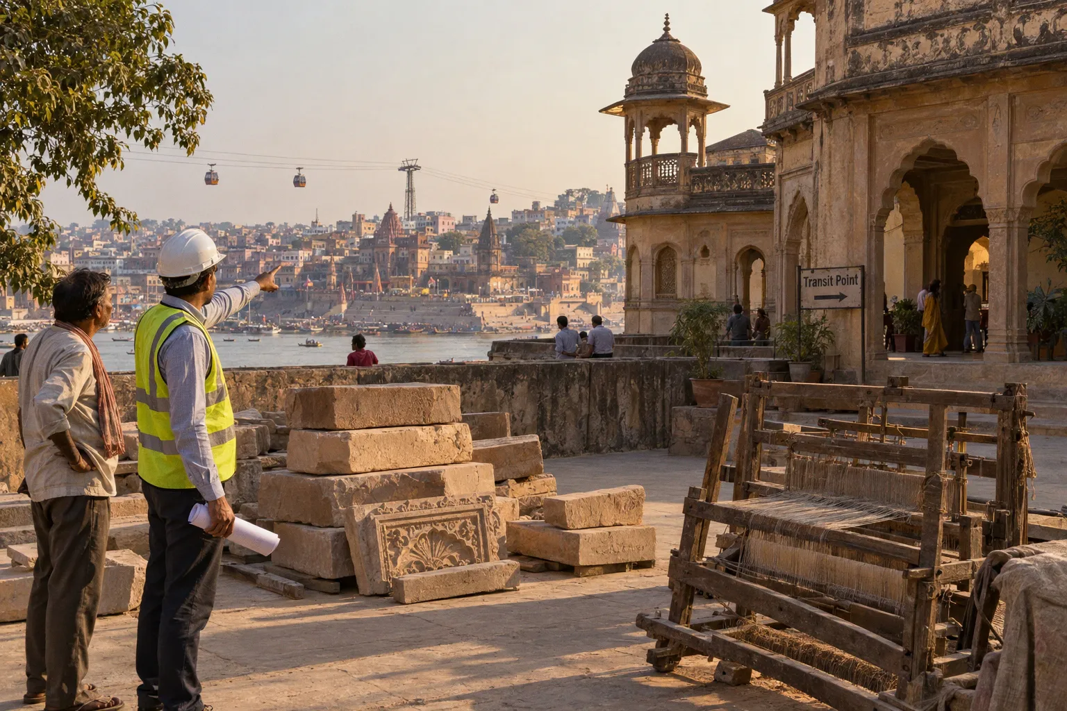
The 3.75 km between the railway terminal and Godowlia Chowk absorbs 45 to 50 minutes of road travel through one of the city's most congested corridors during the working baseline, with longer journeys during peak hours and the festival calendar. A new aerial public transport line is being erected over that exact segment to replace ground-level friction with a suspended 15- to 16-minute journey.
The Varanasi urban ropeway, formally designated the Kashi Ropeway, is India's first public-transport cable car system designed for daily commuter use within a metropolitan grid rather than for tourism or hill-station service alone. Its routing, capacity, and direct integration with the central rail terminal position it as a load-bearing element of the city's evolving multimodal architecture.
The project sits at the intersection of two parallel mobility flows: the long-distance trunk line terminating at the Cantt railway precinct, and the dense pedestrian and vehicular movement feeding the old-city religious core. Tying these flows together by air removes a chokepoint that has long defined the visitor arrival experience. The central question for passengers is therefore not whether Varanasi has two nearby central railway stations, but how quickly and clearly the city's main railway terminal can connect with the ropeway.
This article maps the engineering of that connection: the spatial layout of the five-structure transit route, the efficiency it is expected to deliver against current road alternatives, the system's designed throughput, and the chronology of execution from 2019 planning approval through the 2026 commercial commissioning target.
Bridging the Gap: The 3.75 km Aerial Corridor from Cantt to Godowlia
The corridor in question is fixed in length and direction. The aerial line covers a route distance of 3.75 km, originating at Varanasi Junction, commonly referred to as Varanasi Cantonment or Cantt railway station, and terminating at Godowlia Chowk in the old city. These names refer to the same central railway station, not to two separate co-located terminals. For passengers checking train information, tickets, railway signage, or local directions, the practical point is simple: Varanasi Junction and Varanasi Cantonment identify the same rail hub at the northern end of the ropeway alignment.
The line runs broadly north to south, crossing over the railway terminal's approach zone, the arterial road grid, and the residential blocks that buffer the rail hub from the riverfront temple precinct. Its purpose is to provide a direct aerial connection between the railway station area and Godowlia, rather than to link two different railway stations within one interchange complex.
That distinction matters for anyone researching Varanasi Cantonment station ropeway access or traveling from Varanasi Junction to the ropeway terminal. A passenger does not need to transfer between Varanasi Junction and a separate Cantonment station. The journey begins at the city's principal central railway terminal, then continues through the station precinct toward the ropeway boarding area. The final walking route within the railway complex will depend on the completed station layout, signage, entrances, and operational arrangements, but the transport concept is an interchange between rail and ropeway at the same central hub.
At the southern end, Godowlia Chowk sits within walking distance of the Kashi Vishwanath Temple area and feeds into the Kashi Vishwanath Dham corridor. The ropeway therefore creates a point-to-point alignment between the arrival side of the city and one of the principal access areas for the old-city religious core. At the Cantt end, the station is intended to sit within the railway precinct, allowing a transfer between rail and aerial modes without sending passengers first into the surrounding road network.
The configuration establishes a vertical rather than horizontal link between the two locations. Instead of following every signal, intersection, market approach, and pedestrian bottleneck along the 3.75 km ground path, the ropeway carries passengers above the corridor. That does not eliminate the need for a short walk at either end, nor does it make the old city accessible directly from inside the temple complex. It does, however, separate the longest and most unpredictable part of the arrival journey from surface traffic.
The corridor also functions as a structural element of the broader development plan. It connects two of Varanasi's principal mobility anchors: Cantt as the intercity gateway, and Godowlia as a destination for a large share of pilgrim and visitor movement. In this sense, the ropeway consolidates the first and last miles of long-distance travel into a single aerial leg. The road-based path between the same two points will continue to operate, but its role can shift from primary corridor to feeder alignment once the aerial system enters revenue service.
The Kashi Ropeway is designed to turn a 45- to 50-minute surface journey into a 15- to 16-minute aerial transit, linking Varanasi's central railway hub with the approach to the temple district.
For rail passengers, the most important operational detail is not a second railway station but the quality of the interchange. A ropeway terminal can be geographically close to a station and still be inconvenient if the walking route is unclear, if luggage has to be carried across busy roads, or if feeder vehicles and pedestrians compete for the same entrance. The project will be judged in daily use by the continuity of that transfer: platform, station exit, ropeway entrance, boarding hall, and cabin.
Technical Infrastructure: Understanding the Five-Station Transit Route
The aerial line operates through five structures spaced along the 3.75 km alignment. Four function as passenger stations; one operates exclusively as a turning node. The sequence from the railway terminal outward runs as follows.
| Station or structure | Role | Position on the alignment |
|---|---|---|
| Varanasi Cantonment, or Varanasi Junction, Railway Station | Passenger terminal | Northern anchor and line origin |
| Kashi Vidyapeeth | Passenger station | Intermediate stop |
| Rath Yatra | Passenger station | Intermediate stop |
| Girja Ghar | Technical turn station with no passenger exchange | Intermediate technical node |
| Godowlia Chowk | Passenger terminal | Southern anchor and line terminus |
The Cantt terminal is the system's principal interchange with the railway network. It is associated with the station known as Varanasi Junction and Varanasi Cantonment, rather than representing a separate rail facility. The ropeway's northern terminal is intended to connect this railway precinct with surrounding bus and auto-rickshaw feeder services.
From Cantt, the gondolas move south to Kashi Vidyapeeth, the second passenger stop, serving the university precinct and adjacent residential catchment. The line continues to Rath Yatra, the third passenger station, positioned over one of the more heavily used arterial roads feeding the old city. Girja Ghar, the fourth structure, is a technical turn station. Cabins pass through it without opening, and it is not equipped with passenger boarding or alighting facilities. No passenger can disembark at Girja Ghar.
The line then proceeds to Godowlia Chowk, the southern passenger terminal, situated near the market square that feeds the temple complex. A passenger arriving from the railway station should therefore think of the route as a four-stop passenger service with one non-passenger technical structure, not as a five-stop sightseeing circuit.
The distinction between station and turning node is more than a technical footnote. It affects journey planning, platform information, and the way travel times are understood. Girja Ghar appears in the physical sequence of the project, but it is not an alternative destination for travelers. Passengers heading toward the old city remain in the cabin through the turn and continue toward Godowlia.
The corridor between these structures is supported by 30 towers. Tower heights vary from 10 meters at the lower elevation points to 55 meters at the highest structural sections, calibrated to clear the underlying urban fabric, buildings, road crossings, and the rail terminal's overhead electrification. The variation in tower height reflects the changing conditions along the alignment as it crosses different city blocks between Cantt and Godowlia.
The aerial route is consequently not a uniform cable stretched at one constant height. It is an urban structure that has to maintain clearance over roads and railway infrastructure while accommodating the movement of cabins, cable sag, and the built environment below. That is why tower height and station placement matter to the final passenger experience even when most of the engineering remains invisible from the cabin.
Efficiency Gains: Comparing Aerial Transit Against Traditional Road Congestion
The comparative performance of the ropeway against the existing road corridor is most legible through a direct mode-to-mode assessment. The same journey, from Varanasi Junction—also known as Varanasi Cantonment Railway Station—to Godowlia Chowk, produces sharply different conditions depending on the transport mode.
| Parameter | Road-based travel: taxi, auto, or private vehicle | Kashi Ropeway |
|---|---|---|
| Distance | Approximately 3.75 km by the corridor | 3.75 km on the direct aerial alignment |
| Typical travel time | 45–50 minutes on a working day, often longer during peak hours and festivals | 15–16 minutes of in-cabin travel |
| Congestion exposure | High, with multiple intersections and narrow old-city approaches | No dependence on the road network beneath the line |
| Intermediate stops | Variable and affected by traffic conditions | Fixed passenger stations at Cantt, Kashi Vidyapeeth, Rath Yatra, and Godowlia |
| Weather sensitivity | Exposure to heat, rain, waterlogging, and surface congestion | Subject to wind, lightning, and visibility thresholds |
| Transfer pattern | Road journey from the railway precinct to the old city | Rail-to-ropeway interchange followed by a fixed aerial leg |
The 45- to 50-minute road figure is the operating baseline for a corridor that funnels intercity buses, taxis, auto-rickshaws, two-wheelers, pedestrians, and local traffic through limited road width. The 15- to 16-minute aerial figure represents in-cabin transit time from terminal to terminal, excluding the time required to find the ropeway entrance, join a boarding queue, and walk onward from Godowlia.
That distinction is essential. A ropeway does not turn a train arrival into a door-to-door 15-minute trip. The total journey still includes the movement from the railway platform to the ropeway terminal, any queue at the boarding area, the cabin journey, and the final walk toward a destination in the old city. But the largest variable segment—the surface trip between the central rail hub and Godowlia—is placed on a fixed alignment.
Even with realistic allowances for boarding at periods of high demand, the ropeway is expected to produce a substantial reduction in travel time. More importantly, it should reduce variance. Road travel stretches during monsoon flooding, peak traffic, processions, and festival overcrowding. The aerial line will maintain a near-fixed journey time within its operating envelope, although service can still be affected by wind, lightning, or visibility conditions.
For arriving passengers, the practical sequence is direct:
1. Leave the train at Varanasi Junction, also referred to locally as Varanasi Cantonment or Cantt station.
2. Follow the completed interchange route through the railway precinct toward the ropeway terminal.
3. Board at the northern passenger terminal and remain on the service through the intermediate passenger stations unless the destination requires a stop.
4. Continue to Godowlia Chowk and walk onward toward the temple district, market streets, or another old-city destination.
The same line reverses the equation for departing passengers. A traveler staying near the Godowlia area can reach the ropeway terminal, ride north to the Cantt railway precinct, and then continue to the railway platform. The quality of that journey will depend on the pedestrian connection at both ends, but it avoids making the entire trip through the most congested surface corridor.
The ropeway also changes how the existing road network can be used. Taxis and auto-rickshaws remain necessary for destinations outside the alignment, for passengers with heavy luggage, and for travelers who need a door-to-door trip. Their role becomes more useful as a feeder service to the ropeway rather than as the only way to cross the central corridor. That is the practical meaning of public transport integration: not replacing every road journey, but allowing each mode to handle the part of the trip for which it is best suited.
System Capacity and Operational Scale: Moving 3,000 Passengers Per Hour
The ropeway's designed capacity positions it as a mass-transit asset rather than a leisure attraction. The system runs 153 gondola cars, each carrying up to 10 passengers. Cabins dispatch on a continuous loop, with the ropeway engineered for a peak directional capacity of 3,000 passengers per hour. At that throughput, the system can move up to 96,000 passengers per day across both directions under design load.
A 3,000-passenger-per-hour-per-direction figure places the ropeway within the throughput band of a medium-capacity urban transit line. It does not match the volumes of a metro system, but it is calibrated against the demand profile of a 3.75 km corridor where rail feeders, temple-bound traffic, and old-city circulation converge. The 96,000-passenger daily ceiling is a design maximum rather than a forecast of immediate demand. Actual ridership during the first commercial months is expected to scale from a lower baseline as passengers learn the interchange and as bus, auto, and rail feeder services adapt around it.
Capacity on paper is not the same as capacity experienced by a traveler. The stated figure depends on continuous cabin movement, controlled boarding, station circulation, and the ability to keep the passenger exchange at the four boarding stations efficient. Queue management at Cantt will be particularly important because train arrivals can deliver groups of passengers at once. If the railway-to-ropeway path is easy to understand, the line can absorb those arrivals in a steady flow. If passengers have to search for the terminal or cross through conflicting traffic, the nominal speed of the cable system will matter less.
Girja Ghar is central to this operating logic. It is configured as a turn station, not a passenger stop. Cabins pass through it without opening, and passengers continue aboard toward either Rath Yatra or Godowlia. Passenger exchange is concentrated at Cantt, Kashi Vidyapeeth, Rath Yatra, and Godowlia. Avoiding boarding and alighting at Girja Ghar helps maintain the dwell-time discipline required to sustain the designed throughput.
Any route guidance that treats Girja Ghar as a normal stop would therefore mislead passengers. The structure belongs in descriptions of the engineering route, but not in a list of destinations where travelers can leave the cabin.
The system's physical footprint is also worth noting. The 30 towers occupy discrete points along the corridor rather than requiring continuous land acquisition. That limits surface-level disruption during construction and once the line is operational. Tower heights of 10 to 55 meters maintain ground clearance for road traffic and rail operations while accommodating sag and sway dynamics in the cable profile.
The small number of passenger stations creates both an advantage and a limitation. Fewer stops support a faster end-to-end trip and keep the railway-to-Godowlia connection legible. At the same time, passengers whose final destinations lie away from those four stations will still need a walk or a feeder ride. The ropeway is therefore a spine for central movement, not a replacement for the entire local transport system.
The 153-cabin, 10-passenger-per-gondola configuration is designed for 3,000 passengers per hour in each direction—a mass-transit volume carried on a 3.75 km cable loop above the road network.
Project Execution and Timeline: From Foundation Stone to Commercial Launch
The ropeway's evolution follows a six-year arc from planning inclusion to the expected commercial opening. Each milestone reflects a separate institutional, construction, or engineering gate.
| Date | Milestone |
|---|---|
| December 2019 | RITES incorporates an urban ropeway into Varanasi's MRTS plan |
| December 2021 | Varanasi Development Authority authorises NHLML to implement the project |
| March 2023 | Foundation stone laid by Prime Minister Narendra Modi |
| March 2025 | Safety and operational trial runs commence between Cantt and Rath Yatra |
| 2026 | Expected date for full commercial public operation |
RITES, the engineering consultancy that produced the Varanasi MRTS plan in December 2019, identified the Cantt-to-Godowlia corridor as the priority segment for aerial public transport integration. The plan treated the central railway terminal as the northern interchange point. In this context, references to Cantt and Varanasi Junction should be read as references to the same station, not as evidence of two separate rail terminals requiring a second transfer.
Following that inclusion, the Varanasi Development Authority in December 2021 issued implementation authorisation to National Highways Logistics Management Limited, or NHLML, a Government of India enterprise operating under the Ministry of Road Transport and Highways. NHLML executes the project under the Parvatmala Pariyojana, the national programme targeting ropeway-based connectivity in difficult terrain and dense urban settings.
The Prime Minister laid the foundation stone in March 2023, advancing the construction timeline both procedurally and politically. By March 2025, the first segments had progressed into safety and operational trials, with test runs executed between Cantt and Rath Yatra to verify cabin dispatch, braking, wind tolerance, and emergency evacuation procedures.
The 2026 commercial target reflects the schedule under which full passenger service is expected to commence. Before that can happen, trials must cover the complete operating arrangement, including all passenger stations, the technical turn at Girja Ghar, the terminal interfaces, and the final regulatory requirements. A trial journey is not the same thing as an open passenger service: the system must also have its operating procedures, safety certification, staffing, passenger circulation, and emergency protocols in place.
The financial scale of execution is anchored in a Hybrid Annuity Model, in which capital expenditure is shared between the public executing agency and the contracted private partner. Total project capital expenditure is estimated between ₹645 crore and ₹815 crore. The contracted consortium pairs Vishwa Samudra Engineering with Bartholet Maschinenbau AG, a Swiss ropeway manufacturer with experience in urban transit cable systems.
The division of work reflects the hybrid character of the project. The Swiss partner provides cabin and cable-drive engineering, while the Indian partner executes civil works, station construction, and local integration. The result is not simply a series of towers and cabins but a transport interchange that has to function alongside a busy railway station, arterial roads, market approaches, and a highly sensitive old-city environment.
For passengers following the Kashi ropeway project completion status, the meaningful indicators are therefore broader than the appearance of a completed tower or the start of a test run. Commercial readiness depends on the full line, passenger stations, safety approvals, terminal access, and a working connection between the ropeway and the railway precinct. Until those elements are in place, the 2026 date remains an expected launch target rather than a guarantee of daily public service.
Closing Assessment: The Ropeway's Role in Varanasi's Multimodal Architecture
The Kashi Ropeway fills a specific gap rather than a generic one. India already operates aerial ropeways in pilgrimage, hill, and tourist settings, including systems associated with places such as Manikaran and several hill stations. The Varanasi project applies the technology to a different operating brief: a daily-use public-transport line within a metropolitan mobility grid, linking the central railway terminal with the old city.
That distinction is important. A tourist ropeway is often judged by the view, the attraction at the destination, or the convenience of a single uphill journey. An urban ropeway is judged by repeatability. It must move passengers throughout the day, connect with other modes, provide predictable boarding, and remain useful to people who are not traveling for sightseeing. Varanasi's line is being built around that second model.
The system's near-term significance lies in its connectivity rather than its capacity. At 3,000 passengers per hour in the peak direction, it will not absorb Varanasi's entire commuter or visitor load. At 15- to 16-minute end-to-end transit time, however, it addresses the specific and stubbornly inefficient 3.75 km corridor between the railway terminal and Godowlia.
The project also clarifies an often-confused part of the city's transport geography. A traveler arriving at Varanasi Junction has arrived at the station commonly called Varanasi Cantonment or Cantt. There is no separate Cantonment railway terminal beside Varanasi Junction for the passenger to locate before reaching the ropeway. The relevant connection is between that single central railway hub and the ropeway's northern terminal.
The 30-tower, 153-cabin configuration imposes a relatively light surface footprint compared with a new road corridor, while preserving the underlying street network for local traffic and feeder services. It does not remove the need for better sidewalks, clearer wayfinding, or coordinated access around the railway station. In fact, the ropeway makes those details more visible: the faster the aerial leg becomes, the more frustrating a poorly managed walk between the platform and terminal will feel.
If the 2026 commercial commissioning proceeds on the announced schedule, the ropeway will become a reference point for route planning involving Kashi Vishwanath Temple access from the central railway hub. For arriving pilgrims, the value will be the reduction in uncertainty between train and temple district. For residents, it will be a new cross-city link above a corridor already carrying more movement than its surface network handles comfortably. For Varanasi's transport planners, it will be a test of whether rail, ropeway, road feeders, and pedestrian access can operate as one system rather than as separate projects.
The cable itself is the visible part of the intervention. The real measure of success will be the transfer beneath it: how easily a passenger leaves the train, finds the ropeway, reaches Godowlia, and continues into the city.