Varanasi ring road: transit routes and traffic bypass options
The 59.8 km Varanasi Ring Road, executed by the National Highways Authority of India (NHAI) under the Bharatmala Pariyojana at an estimated cost of ₹3,400 crore, operates as a peripheral bypass rather than a city street.
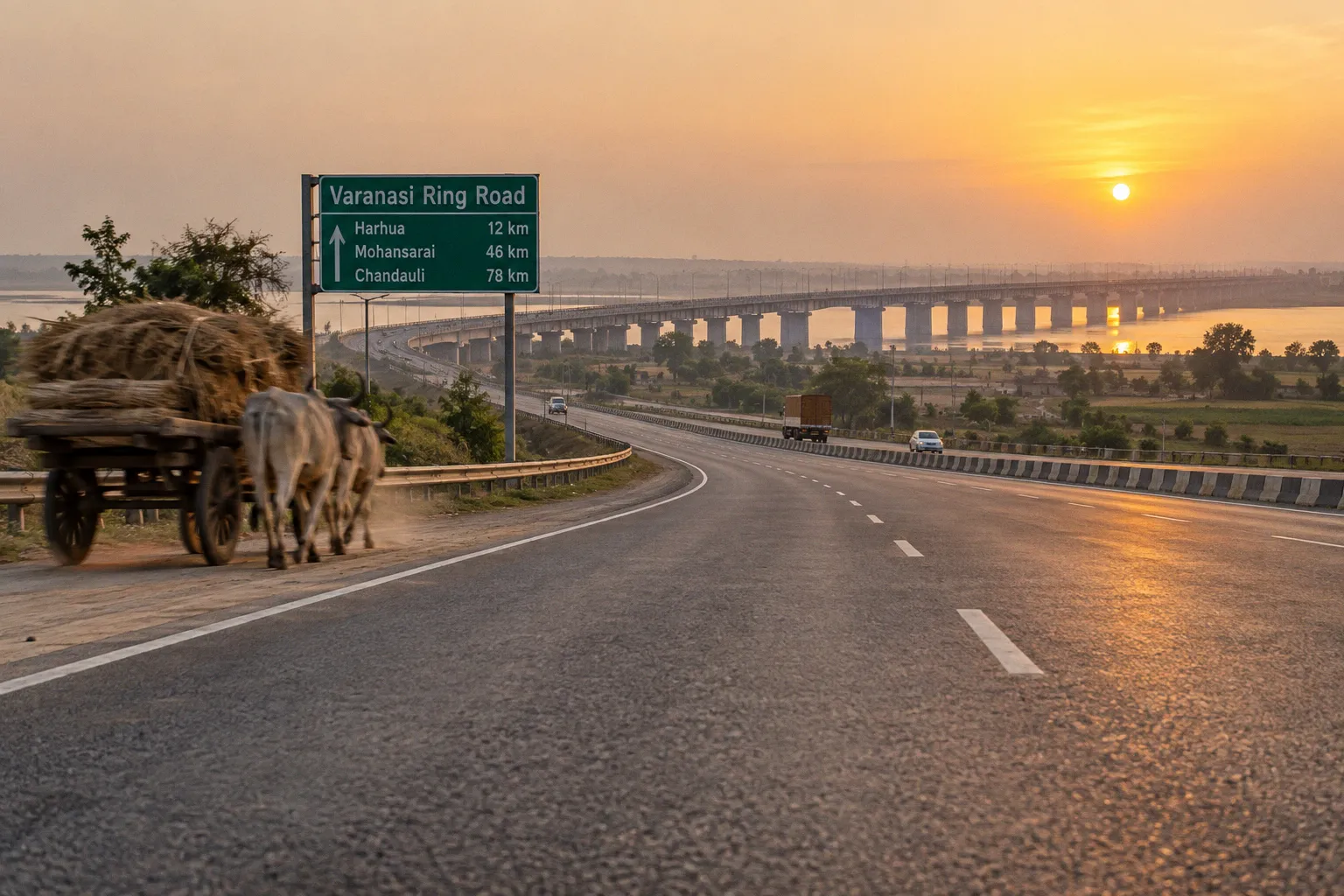
Its function is singular: intercept long-distance traffic before it enters the historic urban core and reroute it around the built-up area between Harhua on the northwestern periphery and Mohansarai on the Varanasi-Chandauli district border. For travelers approaching the city by national highway or arriving at Lal Bahadur Shastri Airport, the corridor offers an alternative to traversing the congested inner road network.
Understanding the 59.8 km Bypass Architecture
The corridor runs as a four-lane highway with engineering provisions for future expansion to six lanes. It links five national highways — NH-19, NH-31, NH-56, NH-233, and NH-29 — through a continuous loop tracing the city's outer edge. Execution began in 2015 under the Bharatmala program; the project has proceeded in measured phases. Phase 1 covered 16.55 km and Phase 2 covered 16.98 km, accounting for roughly 56% of the total alignment in the two initial stages.
The ring road is not a city street. It is a peripheral bypass that redirects long-distance traffic away from the historic core.
The alignment avoids the dense inner-city zones entirely. There is no intersection with the ghats along the riverfront, no passage through Godowlia, and no direct surface access to the heritage precincts. Movement along the corridor requires interchange points rather than at-grade crossings, which preserves traffic continuity on the bypass and prevents surface congestion from spilling back onto the highway.
Strategic Access Points for Airport and Highway Connectivity
Key interchanges distribute traffic between the bypass and the radial road network. The Harhua node on the northwestern segment provides the principal access point for travelers arriving from the airport and the Lucknow–Varanasi corridor (NH-31). From the airport, vehicles enter the bypass at Harhua and continue south or east without crossing the city center. Departures follow the reverse routing: travelers join the bypass at the nearest interchange and exit at the airport connector rather than entering the cantonment zone.
The Mohansarai node at the southeastern terminus links the bypass to the Varanasi–Chandauli border, providing access to traffic moving between Varanasi and the southern districts. The Sandaha-Rewasa bridge forms the eastern interchange cluster, where the ring road crosses the Ganga. The southern interchanges at NH-56 and NH-233 connect the corridor to Azamgarh, Jaunpur, and the eastern districts of Bihar. NH-19, accessed through the western arc, carries the Grand Trunk Road traffic from the Delhi and Kolkata directions.
| Interchange | Highway Linkage | Function |
|---|---|---|
| Harhua (NW) | NH-31 | Lucknow-side entry, airport connector |
| Rewasa (W) | Ganga bridge / western bank | Western landing of Ganga crossing |
| Sandaha (E) | Ganga bridge / eastern bank | Eastern landing of Ganga crossing |
| NH-56 interchange | NH-56 (Varanasi–Jaunpur) | Southern access to Azamgarh / Jaunpur |
| NH-233 / NH-29 interchange | NH-233, NH-29 | Eastern districts connector (Bihar / Jharkhand) |
| Mohansarai (SE) | Varanasi–Chandauli border | Southeast terminus |
Navigating the Sandaha-Rewasa Ganga Bridge Corridor
The most significant engineering feature of the ring road network is the 1.8-km six-lane bridge across the River Ganga connecting Sandaha and Rewasa. The bridge was partially opened to traffic in mid-2025 and forms the only dedicated highway-grade crossing of the Ganga on the bypass. It serves as the central pivot of the loop: without it, the ring road would be two disconnected arcs rather than a continuous bypass.
The crossing carries six lanes of through traffic, fed by widened approach sections at each end. It shortens east-west travel across the metropolitan region substantially. Previously, vehicles moving from the eastern suburbs toward the airport or NH-31 had to descend into the city center and cross either the Malviya Bridge or the road bridge before climbing back to the bypass. The Sandaha-Rewasa crossing eliminates that detour and consolidates east-west movement on a single elevated structure.
The Sandaha-Rewasa bridge is the only highway-grade Ganga crossing on the bypass.
For tourists transiting between the eastern districts and the airport, the bridge is now the standard routing. Travelers heading toward Sarnath from NH-19 or the western side of the city also use this crossing to avoid the cantonment zone.
Future Transit: The 2026 Elevated Varuna and Ganga River Links
On July 15, 2026, the Union Cabinet approved two elevated connector corridors under the Hybrid Annuity Model (HAM) to extend the ring road's reach. The Varuna River corridor will run 43.2 km at an estimated cost of ₹10,998.32 crore. The Ganga River corridor will run 46 km at an estimated cost of ₹14,447.64 crore. Combined, the two projects account for ₹25,446 crore in sanctioned expenditure.
Both corridors are designed for operational speeds of 80–100 km/h and link NH-31 and NH-19 directly to the existing ring road. The Varuna corridor traces the southern flank of the city; the Ganga corridor runs along the river's western edge. Neither is fully constructed as of mid-2026; both remain in the development pipeline.
| Parameter | Varuna River Corridor | Ganga River Corridor |
|---|---|---|
| Length | 43.2 km | 46 km |
| Sanctioned cost | ₹10,998.32 crore | ₹14,447.64 crore |
| Construction model | HAM | HAM |
| Design speed | 80–100 km/h | 80–100 km/h |
| Status (mid-2026) | Approved, under development | Approved, under development |
Once operational, the elevated corridors will reduce dependence on surface-level city roads for cross-river and cross-corridor traffic. Travelers heading from the airport toward Sarnath, for example, will be able to remain on the elevated system for a longer portion of the journey, bypassing at-grade intersections entirely.
Optimizing Travel Time Between Sarnath and Major Transit Hubs
Sarnath is connected to the broader transport network through two principal routes: an inner-city road from the cantonment area, and a peripheral route that uses a section of the ring road combined with the Sarnath branch connector. For travelers arriving from the airport or NH-31, the peripheral route is the more direct option. The journey runs from the airport connector to the Harhua node, then southeast along the ring road to the Sarnath interchange, and finally along the dedicated Sarnath access road. This routing avoids the city core entirely and bypasses the railway-overbridge bottlenecks that form during peak hours.
Travelers arriving from NH-19 use the ring road's western arc to reach the Sarnath branch without entering the cantonment zone. From NH-56 and NH-233, the routing passes through the Sandaha-Rewasa bridge and the eastern arc before turning north to Sarnath.
Three standard routings cover most travel scenarios:
- Airport ↔ Sarnath: Airport connector → Harhua interchange → ring road (northwest segment) → Sarnath branch connector.
- NH-19 (west) ↔ Sarnath: Western arc of the ring road → Sarnath branch connector, avoiding the cantonment.
- NH-56 / NH-233 (south and east) ↔ Sarnath: Sandaha-Rewasa bridge → eastern arc → Sarnath branch connector.
The peripheral route to Sarnath is consistently faster than the inner-city approach during peak congestion hours.
Travelers should plan around the standard morning and evening peak windows, when the inner-city corridors experience the heaviest congestion and the peripheral routing offers the largest time advantage.
Conclusion
The Varanasi Ring Road, executed in phases since 2015, now functions as the primary peripheral bypass for the metropolitan area. Its 59.8 km alignment, the 1.8-km Sandaha-Rewasa Ganga bridge partially opened in mid-2025, and the interchange network connecting NH-19, NH-31, NH-56, NH-233, and NH-29 provide a continuous bypass that avoids the historic core. The two elevated corridors approved in July 2026 — totaling 89.2 km and ₹25,446 crore — will extend this function once they enter service and shift a larger share of cross-corridor traffic onto grade-separated infrastructure. For travelers navigating between the airport, Sarnath, and the national highway network, the bypass is now the standard routing.